
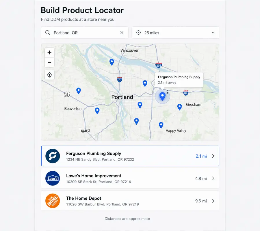
A locator someone can actually use
Locations plus searchable, filterable results — so a visitor finds the dealer, store or provider that fits, rather than scanning pins.
Connect WordPress content, spreadsheets, commerce, CRMs, APIs, and other data sources to one reusable DDM Dataset, then present those records as maps, directories, filtered results, search experiences, and more.
The data layer and the presentation stay separate, so one dataset can drive a map on one page and a filtered list on another. What normally takes custom queries, templates, geocoding and sync is configuration instead.
Coming soon: Data Driven Maps Free on WordPress.org, with DDM Pro launching at the same time.
DDM keeps the data layer separate from the way it is presented. That is the whole design: the same records can drive a map on one page and a filtered list on another, and neither has to be rebuilt when the data changes.
Upload a CSV, use posts and custom post types you already have, or connect the system that owns the records. No rebuilding your data to make it usable.
Choose the fields the experience actually needs — titles, categories, status, price, dates, images, and addresses when the thing is spatial.
Maps, lists and loops, filtering, sorting, search, and a results view kept synchronized with the map — configured, not coded.
Place it with blocks and supported embeds, then change the data later without touching the page that uses it.
Build the experience, not the plumbing.
A spreadsheet, a CSV export, your own posts and custom post types, a product catalogue, a CRM, or a structured API. Data Driven Maps reads the records, you decide what the visitor does with them — and the same dataset can serve more than one page.
Start from the data you have
Publish what the visitor needs
Not every dataset is spatial and not every answer is a map. A record set that has no coordinates can still drive a searchable list, and the same records can become a map on one page and a filtered loop on another — which is why the data layer and the presentation are separate things in DDM rather than one setting on a shortcode.
What you can build
Four compositions, all built the same way: records in a dataset, then a presentation that decides what the visitor does with them. The map, the results list, the filters and the indoor plan are the same system configured differently — not four separate products.
Locations plus searchable, filterable results — so a visitor finds the dealer, store or provider that fits, rather than scanning pins.
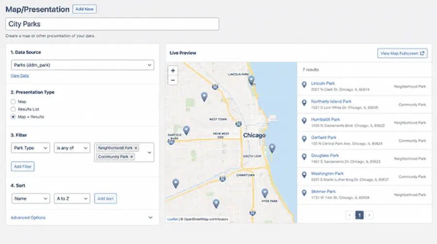
The presentation is an object you edit, reuse and reassign — not a shortcode with forty attributes.
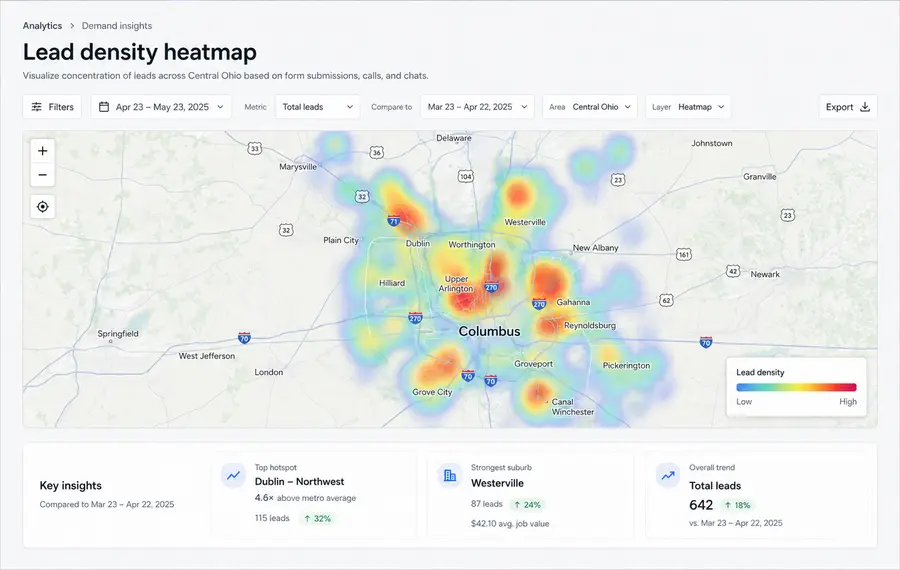
One dataset, another way of reading it. No second import, no parallel copy to maintain.
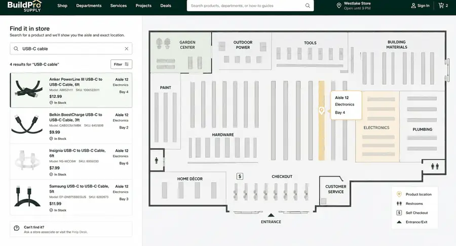
Product records plus aisle or zone data, so a shopper can search for an item and see where it is inside the building.
Every one of these is the same two moves: get the records in, decide what the visitor does with them.
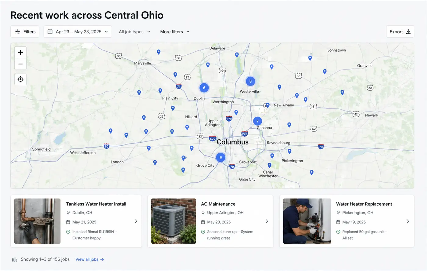
Turn completed jobs into a map of real work across the service area, instead of a static list of city names.
Dealers, stores, offices, providers and destinations — searchable, filterable, and distance-aware where that changes the answer.
Member, resource and partner data as an interface people can browse — not an archive template with a map bolted on.
Listings on a map and in a synchronized results grid, filtered by the fields buyers actually sort on.
Stores, venues, campuses and warehouses, where the useful question is which aisle rather than which city.
Stop rebuilding the same queries, map wiring and synchronization for every client. Keep the custom work for what is actually custom.
Integrations
A connector supplies records. DDM decides what those records become — a map, a list, search, filters, an indoor finder. The source does not have to contain coordinates to be useful.
The next project rarely uses the same stack as the last one. The foundation should not have to change with it.
Four parts, and what each one is for. Prices come from the DDM product catalogue and are shown on the pricing page.
Free
Bring structured data in and build real maps and reusable presentations without buying anything. No account needed for the normal free workflow.
Paid foundation
One product, sold for one site, five, or fifty. How many sites can activate it is what changes, never which features you get.
Optional
Specialised jobs that do not belong on every install — advanced search, proximity, routes, automated sync, analytics, indoor mapping — and the connectors. Both require Pro.
Bundled
For repeat work: Pro plus the pieces you would otherwise assemble project by project, under one license.
Annual licenses with the renewal terms stated up front. No first-year price that quietly doubles.
Paid extensions need Pro — but needing Pro never means buying the whole catalogue to get one thing.
If a license lapses, what is installed keeps working. Updates and paid support are what require an active license.
Third-party costs — map providers, CRMs, AI providers — are never quietly folded in. Each is stated where it applies.
This is being built from real projects, not personas. Four questions and one optional one. If your answer changes what gets built first, we would rather know now than after launch.
One email, when it launches. That is the whole commitment.
Your answers go to the people building it. Not to an ad platform, not to a list broker, not to a nurture sequence.
One email, when it launches.
That is the whole commitment.